 mundialis GeoNetwork catalogue
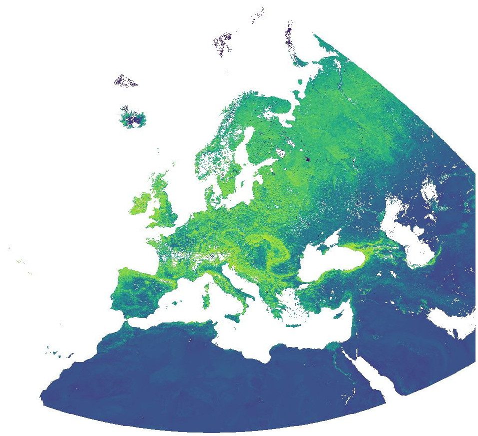
MODIS NDVI and EVI, 16-day time series for Europe at 1 km resolution
Normalized Difference Vegetation Index (NDVI) and Enhanced Vegetation Index (EVI) from MODIS data for Europe at 1 km resolution.
Source data:
- MODIS/Terra Vegetation Indices 16-Day L3 Global 500 m SIN Grid (MOD13A1 v006): https://lpdaac.usgs.gov/products/mod13a1v006/
- MODIS/Aqua Vegetation Indices 16-Day L3 Global 500 m SIN Grid (MYD13A1 v006): https://lpdaac.usgs.gov/products/myd13a1v006/
The MOD/MYD13A1 Version 6 product provide Vegetation Index (VI) values at a per pixel basis at 500 meter (m) spatial resolution. There are two primary vegetation layers. The first is the Normalized Difference Vegetation Index (NDVI), which is referred to as the continuity index to the existing National Oceanic and Atmospheric Administration-Advanced Very High Resolution Radiometer (NOAA-AVHRR) derived NDVI. The second vegetation layer is the Enhanced Vegetation Index (EVI), which has improved sensitivity over high biomass regions. The algorithm for this product chooses the best available pixel value from all the acquisitions from the 16 day period. The criteria used is low clouds, low view angle, and the highest NDVI/EVI value.
For the time periods October 2016 - March 2017 and August 2020 - April 2021, the original data has been reprojected to ETRS89-extended / LAEA Europe and aggregated to a 1 km grid. The temporal resolution is 16 days. Bad quality pixels or pixels with snow/ice and/or cloud cover have been masked using the provided quality assurance (QA) layers and appear as "no data".
File naming:
productCode.acquisitionDate[A (YYYYDDD)]_mosaic_spatialResolution_frequency_VI.tif
example: MOD13A1.A2020305_mosaic_1000m_16_days_NDVI.tif
The date is Year and Day of Year.
Values are NDVI/EVI * 10000. Example: Value 6473 = 0.6473
Simple
- Date (Publication)
- 2021-10-29
- Citation identifier
- 10.5281/zenodo.6573852
- Status
- Completed
- Point of contact
-
Organisation name Individual name Electronic mail address Role mundialis GmbH & Co. KG
Point of contact
- Maintenance and update frequency
- As needed
- Theme
-
-
NDVI
-
EVI
-
Vegetation Index
-
- Place
-
-
Europe
-
-
GEMET - INSPIRE themes, version 1.0
-
-
Land cover
-
- Theme
-
-
MOOD-H2020
-
Lyme
-
TBE
-
WNV
-
USUTU
-
- Use limitation
-
None
- Access constraints
- Other restrictions
- Other constraints
- no limitations to public access
- Other constraints
-
All data products distributed by NASA's Land Processes Distributed Active Archive Center (LP DAAC) are available at no charge.
- Access constraints
- Other restrictions
- Use constraints
- License
- Other constraints
-
All LP DAAC current data and products acquired through the LP DAAC have no restrictions on reuse, sale, or redistribution.
The LP DAAC requests that any author using NASA data products in their work provide credit for the data, and any assistance provided by the LP DAAC, in the data section of the paper, the acknowledgement section, and/or as a reference. The recommended citation for each data product is available on its Digital Object Identifier (DOI) Landing page, which can be accessed through the Search Data Catalog interface.
For full information on LP DAAC Data Citation and Policies, see: https://lpdaac.usgs.gov/data/data-citation-and-policies/
- Aggregate Datasetindentifier
- b4bfcab8-7dad-4bf2-961e-a1615c2ac67f
- Association Type
- Cross reference
- Spatial representation type
- Grid
- Distance
- 1 km
- Language
- English
- Character set
- UTF8
- Topic category
-
- Geoscientific information
- Description
-
Europe
- Begin date
- 2016-10-01
- End date
- 2017-03-31
- Begin date
- 2020-08-01
- End date
- 2021-04-30
))
- Unique resource identifier
- EPSG:3035
- Distribution format
-
Name Version GeoTIFF
Digital transfer options
- OnLine resource
-
Protocol Linkage Name WWW:DOWNLOAD-1.0-http--download
https://zenodo.org/record/6573852/files/MODIS_NDVI_v01.zip?download=1 WWW:DOWNLOAD-1.0-http--download
https://zenodo.org/record/6573852/files/MODIS_NDVI_EVI.sld?download=1 WWW:DOWNLOAD-1.0-http--download
https://zenodo.org/record/6573852/files/MODIS_NDVI_EVI.qml?download=1 WWW:DOWNLOAD-1.0-http--download
https://zenodo.org/record/6573852/files/MODIS_EVI_v01.zip?download=1 WWW:DOWNLOAD-1.0-http--download
https://zenodo.org/record/6573852/files/MODIS_NDVI_EVI.sld?download=1 WWW:DOWNLOAD-1.0-http--download
https://zenodo.org/record/6573852/files/MODIS_NDVI_EVI.qml?download=1
- Hierarchy level
- Dataset
Conformance result
- Title
-
COMMISSION REGULATION (EU) No 1089/2010 of 23 November 2010 implementing Directive 2007/2/EC of the European Parliament and of the Council as regards interoperability of spatial data sets and services
- Date (Publication)
- 2010-12-08
- Other citation details
- Explanation
-
See specified reference
- Pass
- Yes
- Statement
-
Derived from MODIS Terra/Aqua Vegetation Indices 16-Day L3 Global 500 m SIN Grid. Bad quality pixels or pixels with snow/ice and/or cloud cover have been masked using the provided quality assurance (QA) layers.
Metadata
- File identifier
- 4ea3b1e9-d3d0-4c3f-afb1-6445cec3a89d XML
- Metadata language
- English
- Character set
- UTF8
- Hierarchy level
- Dataset
- Date stamp
- 2024-07-02T10:27:32
- Metadata standard name
-
ISO 19115:2003/19139
- Metadata standard version
-
1.0
- Metadata author
-
Organisation name Individual name Electronic mail address Role mundialis GmbH & Co. KG
Point of contact
)))