 mundialis GeoNetwork catalogue
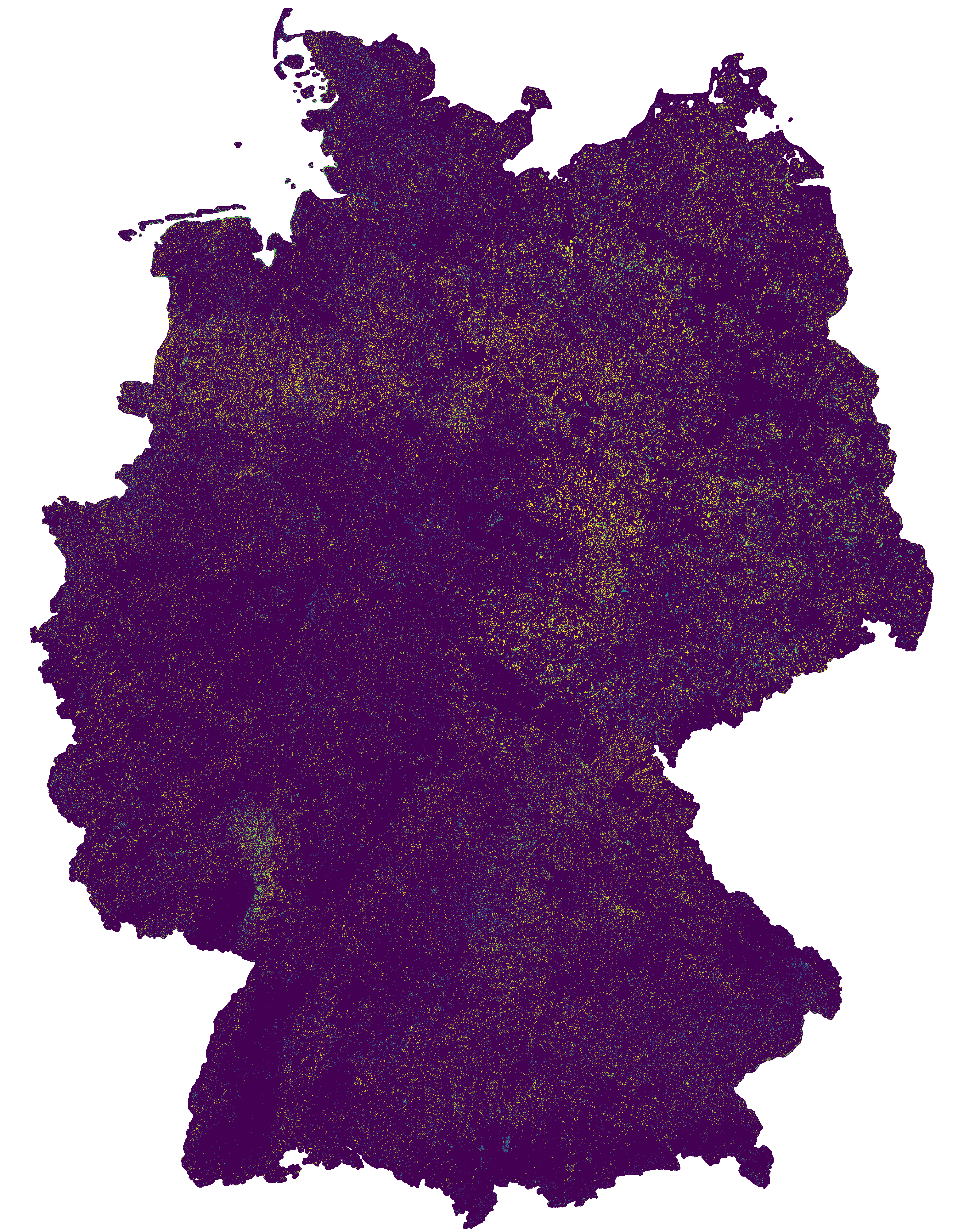
Change Detection map of Germany 2016-2019 based on Sentinel-2 data
This change map was produced as an intermediate result in the course of the project incora (Inwertsetzung von Copernicus-Daten für die Raumbeobachtung, mFUND Förderkennzeichen: 19F2079C) in cooperation with ILS (Institut für Landes- und Stadtentwicklungsforschung gGmbH) and BBSR (Bundesinstitut für Bau-, Stadt- und Raumforschung) funded by BMVI (Federal Ministry of Transport and Digital Infrastructure). The goal of incora is an analysis of settlement and infrastructure dynamics in Germany based on Copernicus Sentinel data.
The map indicates land cover changes between the years 2016 and 2019. It is a difference map from two classifications based on Sentinel-2 MAJA data (MAJA L3A-WASP: https://geoservice.dlr.de/web/maps/sentinel2:l3a:wasp; DLR (2019): Sentinel-2 MSI - Level 2A (MAJA-Tiles)- Germany). More information on the two basis classifications can be found here:
To keep only significant changes in the change detection map, the following postprocessing steps are applied to the initial difference raster:
- Modefilter (3x3) to eliminate isolated pixels and edge effects
- Information gain in a 4x4 window compares class distribution within the window from the two timesteps. High values indicate that the class distribution in the window has changed, and thus a change is likely. Gain ranges from 0 to 1, all changes < 0.5 are omitted.
- Change areas < 1ha are removed
The resulting map has the following nomenclature:
0: No Change
1: Change from low vegetation to forest
2: Change from water to forest
3: Change from built-up to forest
4: Change from bare soil to forest
5: Change from agriculture to forest
6: Change from forest to low vegetation
7: Change from water to low vegetation
8: Change from built-up to low vegetation
9: Change from bare soil to low vegetation
10: Change from agriculture to low vegetation
11: Change from forest to water
12: Change from low vegetation to water
13: Change from built-up to water
14: Change from bare soil to water
15: Change from agriculture to water
16: Change from forest to built-up
17: Change from low vegetation to built-up
18: Change from water to built-up
19: Change from bare soil to built-up
20: Change from agriculture to built-up
21: Change from forest to bare soil
22: Change from low vegetation to bare soil
23: Change from water to bare soil
24: Change from built-up to bare soil
25: Change from agriculture to bare soil
26: Change from forest to agriculture
27: Change from low vegetation to agriculture
28: Change from water to agriculture
29: Change from built-up to agriculture
30: Change from bare soil to agriculture
- Contains modified Copernicus Sentinel data (2016/2019), processed by mundialis
Incora report with details on methods and results: pending
Simple
- Date (Publication)
- 2020-12-01
- Citation identifier
- dataset
- Status
- On going
- Point of contact
-
Organisation name Individual name Electronic mail address Role mundialis GmbH & Co. KG
Point of contact
- Maintenance and update frequency
- Irregular
- Theme
-
-
Sentinel-2
-
Classification
-
Land Cover
-
mFUND
-
MAJA
-
Infrastuktur
-
Umwelt
-
Regionen und Städte
-
mfund-projekt:incora
-
mfund-fkz:19F2079C
-
Change Detection
-
Settlement Dynamics
-
incora
-
- Place
-
-
Germany
-
-
GEMET - INSPIRE themes, version 1.0
-
-
Land cover
-
Land use
-
- Use limitation
-
None
- Access constraints
- Other restrictions
- Use constraints
- License
- Other constraints
- no limitations to public access
- Other constraints
-
Data licence Germany - attribution - version 2.0 or later (DL-DE->BY-2.0) | Datenlizenz Deutschland - Namensnennung - Version 2.0 oder neuer
- Other constraints
-
{ "id": "dl-by-de/2.0", "name": "Datenlizenz Deutschland Namensnennung 2.0", "url": " https://www.govdata.de/dl-de/by-2-0", "quelle": "Source: mundialis GmbH & Co. KG" }
- Aggregate Datasetindentifier
- 36512b46-f3aa-4aa4-8281-7584ec46c813
- Association Type
- Source
- Aggregate Datasetindentifier
- db130a09-fc2e-421d-95e2-1575e7c4b45c
- Association Type
- Source
- Aggregate Datasetindentifier
- ad2646e3-5667-40bd-b80b-73151949747c
- Association Type
- Cross reference
- Spatial representation type
- Grid
- Distance
- 10 meters
- Language
- English
- Character set
- UTF8
- Topic category
-
- Geoscientific information
- Description
-
Germany
- Begin date
- 2016-01-01
- End date
- 2019-12-31
))
- Reference system identifier
- EPSG:32632 (UTM 32N)
- Distribution format
-
Name Version GeoTIFF
1.0
Digital transfer options
- OnLine resource
- Hierarchy level
- Dataset
Conformance result
- Title
-
COMMISSION REGULATION (EU) No 1089/2010 of 23 November 2010 implementing Directive 2007/2/EC of the European Parliament and of the Council as regards interoperability of spatial data sets and services
- Date (Publication)
- 2010-12-08
- Other citation details
- Explanation
-
See specified reference
- Pass
- Yes
- Statement
-
derived from Sentinel-2 MSI - Level 3A-WASP
Metadata
- File identifier
- 5ef8565b-ea72-4f34-985b-71ab41959230 XML
- Metadata language
- English
- Character set
- UTF8
- Hierarchy level
- Dataset
- Date stamp
- 2021-10-25T13:11:07
- Metadata standard name
-
ISO 19115:2003/19139
- Metadata standard version
-
1.0
- Metadata author
-
Organisation name Individual name Electronic mail address Role mundialis GmbH & Co. KG
Point of contact
)))