 mundialis GeoNetwork catalogue
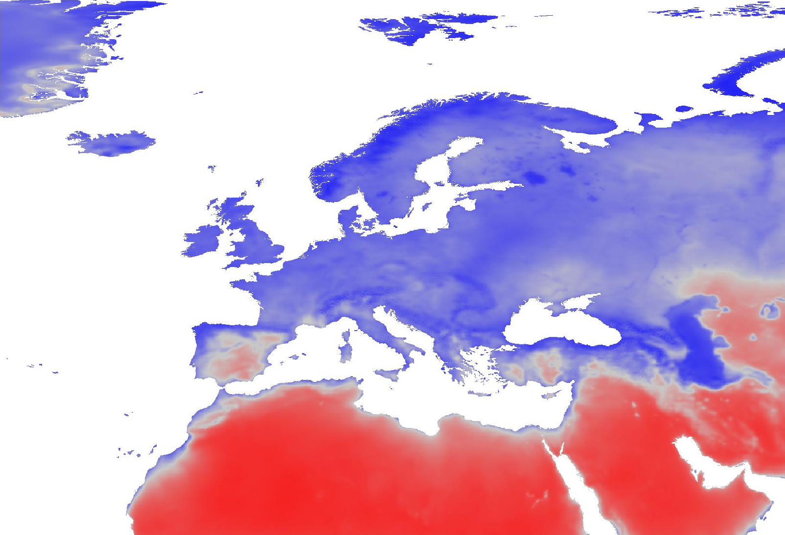
Monthly time series of spatially enhanced relative humidity for Europe at 30 arc seconds resolution (2000 - 2023) derived from ERA5-Land data
Overview:
ERA5-Land is a reanalysis dataset providing a consistent view of the evolution of land variables over several decades at an enhanced resolution compared to ERA5. ERA5-Land has been produced by replaying the land component of the ECMWF ERA5 climate reanalysis. Reanalysis combines model data with observations from across the world into a globally complete and consistent dataset using the laws of physics. Reanalysis produces data that goes several decades back in time, providing an accurate description of the climate of the past.
Processing steps:
The original hourly ERA5-Land air temperature 2 m above ground and dewpoint temperature 2 m data has been spatially enhanced from 0.1 degree to 30 arc seconds (approx. 1000 m) spatial resolution by image fusion with CHELSA data (V1.2) ( https://chelsa-climate.org/). For each day we used the corresponding monthly long-term average of CHELSA. The aim was to use the fine spatial detail of CHELSA and at the same time preserve the general regional pattern and fine temporal detail of ERA5-Land. The steps included aggregation and enhancement, specifically:
1. spatially aggregate CHELSA to the resolution of ERA5-Land
2. calculate difference of ERA5-Land - aggregated CHELSA
3. interpolate differences with a Gaussian filter to 30 arc seconds.
4. add the interpolated differences to CHELSA
Subsequently, the temperature time series have been aggregated on a daily basis. From these, daily relative humidity has been calculated for the time period 01/2000 - 12/2023.
Relative humidity (rh2m) has been calculated from air temperature 2 m above ground (Ta) and dewpoint temperature 2 m above ground (Td) using the formula for saturated water pressure from Wright (1997):
maximum water pressure = 611.21 * exp(17.502 * Ta / (240.97 + Ta))
actual water pressure = 611.21 * exp(17.502 * Td / (240.97 + Td))
relative humidity = actual water pressure / maximum water pressure
The resulting relative humidity has been aggregated to monthly averages.
Resultant values have been converted to represent percent * 10, thus covering a theoretical range of [0, 1000].
File naming scheme (YYYY = year; MM = month):
ERA5_land_rh2m_avg_monthly_YYYY_MM.tif
Projection + EPSG code:
Latitude-Longitude/WGS84 (EPSG: 4326)
Spatial extent:
north: 82:00:30N
south: 18N
west: 32:00:30W
east: 70E
Spatial resolution:
30 arc seconds (approx. 1000 m)
Temporal resolution:
Monthly
Pixel values:
Percent * 10 (scaled to Integer; example: value 738 = 73.8 %)
Software used:
GDAL 3.2.2 and GRASS GIS 8.0.0/8.3.2
Original ERA5-Land dataset license:
https://apps.ecmwf.int/datasets/licences/copernicus/
CHELSA climatologies (V1.2):
Data used: Karger D.N., Conrad, O., Böhner, J., Kawohl, T., Kreft, H., Soria-Auza, R.W., Zimmermann, N.E, Linder, H.P., Kessler, M. (2018): Data from: Climatologies at high resolution for the earth's land surface areas. Dryad digital repository. http://dx.doi.org/doi:10.5061/dryad.kd1d4
Original peer-reviewed publication: Karger, D.N., Conrad, O., Böhner, J., Kawohl, T., Kreft, H., Soria-Auza, R.W., Zimmermann, N.E., Linder, P., Kessler, M. (2017): Climatologies at high resolution for the Earth land surface areas. Scientific Data. 4 170122. https://doi.org/10.1038/sdata.2017.122
Processed by:
mundialis GmbH & Co. KG, Germany ( https://www.mundialis.de/)
Reference: Wright, J.M. (1997): Federal meteorological handbook no. 3 (FCM-H3-1997). Office of Federal Coordinator for Meteorological Services and Supporting Research. Washington, DC
Data is also available in EU LAEA (EPSG: 3035) projection: https://data.mundialis.de/geonetwork/srv/eng/catalog.search#/metadata/ab06ed25-84af-43c9-b1c3-57e3b6ad8d29
Acknowledgements: This study was partially funded by EU grant 874850 MOOD. The contents of this publication are the sole responsibility of the authors and don't necessarily reflect the views of the European Commission.
Simple
- Date (Publication)
- 2024-07-11
- Edition
-
1.2.0
- Citation identifier
- dataset
- Status
- On going
- Point of contact
-
Organisation name Individual name Electronic mail address Role mundialis GmbH & Co. KG
Markus Metz
Point of contact
- Maintenance and update frequency
- As needed
- Theme
-
-
relative humidity
-
geospatial analysis
-
environment
-
meteorology
-
ERA5-Land
-
CHELSA
-
- Place
-
-
Europe
-
-
GEMET - INSPIRE themes, version 1.0
-
-
Atmospheric conditions
-
Meteorological geographical features
-
- Theme
-
-
MOOD-H2020
-
Tularaemia
-
Lyme
-
TBE
-
WNV
-
USUTU
-
Mosquito borne Flaviviruses
-
- Use limitation
-
None
- Access constraints
- Other restrictions
- Other constraints
- no limitations to public access
- Access constraints
- Other restrictions
- Use constraints
- License
- Other constraints
-
Creative Commons Namensnennung – 4.0 International (CC BY 4.0)
- Other constraints
-
{ "id": "cc-by/4.0", "name": "Creative Commons Namensnennung – 4.0 Internationa", "url": " http://creativecommons.org/licenses/by/4.0/", "quelle": "Source: mundialis GmbH & Co. KG" }
- Aggregate Datasetindentifier
- eb4a552e-6782-415f-81ea-89ea1a584635
- Association Type
- Cross reference
- Aggregate Datasetindentifier
- 782cdbf5-bfda-4813-a5d7-336ebbc241bb
- Association Type
- Cross reference
- Spatial representation type
- Grid
- Distance
- 30 arc-seconds
- Language
- English
- Character set
- UTF8
- Topic category
-
- Geoscientific information
- Climatology, meteorology, atmosphere
- Description
-
Europe
- Begin date
- 2000-01-01
- End date
- 2023-12-31
))
- Unique resource identifier
- EPSG:4326
- Distribution format
-
Name Version GeoTIFF
Digital transfer options
- OnLine resource
-
Protocol Linkage Name WWW:DOWNLOAD-1.0-http--download
https://doi.org/10.5281/zenodo.6146383
- Hierarchy level
- Dataset
Conformance result
- Title
-
COMMISSION REGULATION (EU) No 1089/2010 of 23 November 2010 implementing Directive 2007/2/EC of the European Parliament and of the Council as regards interoperability of spatial data sets and services
- Date (Publication)
- 2010-12-08
- Other citation details
- Explanation
-
See specified reference
- Pass
- Yes
- Statement
-
derived from ERA5-Land reanalysis data, spatially enhanced by image fusion with CHELSA data
Metadata
- File identifier
- b9ce7dba-4130-428d-96f0-9089d8b9f4a5 XML
- Metadata language
- English
- Character set
- UTF8
- Hierarchy level
- Dataset
- Date stamp
- 2024-07-11T06:54:02
- Metadata standard name
-
ISO 19115:2003/19139
- Metadata standard version
-
1.0
- Metadata author
-
Organisation name Individual name Electronic mail address Role mundialis GmbH & Co. KG
Point of contact
)))