 mundialis GeoNetwork catalogue
CLMS Water Bodies monthly time series for Mauritania at 30 arc seconds (ca. 1000 meter) resolution (2019 - 2023)
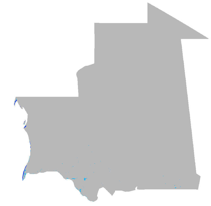
Water Bodies from Copernicus Land Monitoring Service (CLMS) as monthly time series for Mauritania at 30 arc seconds (ca. 1000 meter) resolution (2019 - 2023)
Source data:
- CLMS: Water Bodies 2014-2020 (raster 300 m), global, 10-daily – version 1: https://land.copernicus.eu/en/products/water-bodies/water-bodies-global-v1-0-300m
- CLMS: Water Bodies 2020-present (raster 300 m), global, monthly – version 2: https://land.copernicus.eu/en/products/water-bodies/water-bodies-global-v2-0-300m
Water is fundamental to life on Earth. Water quality, including aspects like turbidity and trophic state, is vital for assessing a water body's ecological well-being and its suitability for drinking. Understanding the water's surface temperature is key for monitoring climate change and can influence weather patterns. Tracking water levels in lakes and rivers helps in flood prediction, irrigation planning, and hydroelectric power generation. The presence and extent of ice on lakes and rivers can have significant implications for regional climates, ecosystems, and human activities. Moreover, the surface extent of water bodies, whether permanent or ephemeral, informs land management across various sectors. In an era marked by environmental change, these metrics offer insights into sustainable water resource management.
The Water Bodies product group aims to address these critical issues by providing tailored datasets to users which are applicable across a wide array of sectors. It includes Lake Surface Water Temperature, providing real-time and historical data; Lake Water Quality in various resolutions; Water Bodies datasets for surface extent; Lake and River Water Level information; the River and Lake Ice Extent product for ice presence; and the Aggregated River and Lake Ice Extent product, showing percent ice coverage. These products support applications like food security, public health safeguarding, climate studies, and responsible water management practices.
Processing steps:
To cover the complete time period from 2019 to 2023 two data products of the Water Bodies product group are processed. Up to December of 2020 the Water Bodies at 10-daily resolution have been used, from January 2021 the Water Bodies at monthly resolution have been used. Both original datasets have been downloaded for the area of Mauritania (NUTS MR) within Latitude-Longitude/WGS84 spatial reference system. Then both datasets have been downsampled to 30 arc seconds (ca. 1000 meter) using the most frequent occuring value. The 10-daily data have been aggregated to monthly resolution using the most frequent occurring value.
File naming:
Until December 2020: c_gls_WB300_GLOBE_PROBAV_V1.0.1_MR_WB_res_YYYY_MM_01T00_00_00.tif
e.g.: c_gls_WB300_GLOBE_PROBAV_V1.0.1_MR_WB_res_2020_12_01T00_00_00.tif
From January 2021 on: c_gls_WB300_GLOBE_S2_V2.0.1_MR_WB_res_YYYY_MM_01T00_00_00.tif
e.g.: c_gls_WB300_GLOBE_S2_V2.0.1_MR_WB_res_2023_12_01T00_00_00.tif
The date within the filename is year and month of aggregated timestamp.
NOTE: data for 2023-04 are missing, since they are not available from CLMS
Pixel values:
0: Sea
70: Water
255: No water
Projection + EPSG code:
Latitude-Longitude/WGS84 (EPSG: 4326)
Spatial extent:
north: 27:17:30N
south: 14:43:30N
west: 17:04:30W
east: 04:48:00W
Temporal extent:
January 2019 - December 2023 (except: April 2023)
Spatial resolution:
30 arc seconds (approx. 1000 m)
Temporal resolution:
monthly
Software used:
GRASS GIS 8.3.2
Format: GeoTIFF
Original dataset license:
Generated using European Union's Copernicus Land Monitoring Service information
Processed by:
mundialis GmbH & Co. KG, Germany ( https://www.mundialis.de/)
Contact:
mundialis GmbH & Co. KG, info@mundialis.de
Acknowledgements:
This study was partially funded by EU grant 874850 MOOD. The contents of this publication are the sole responsibility of the authors and don't necessarily reflect the views of the European Commission.
Simple
- Date (Publication)
- 2024-06-21
- Citation identifier
- 10.5281/zenodo.12189682
- Status
- On going
- Point of contact
-
Organisation name Individual name Electronic mail address Role mundialis GmbH & Co. KG
Point of contact
- Maintenance and update frequency
- As needed
- Theme
-
-
MOOD-H2020
-
Water
-
Water bodies
-
RVF
-
Rift Valley fever
-
- Place
-
-
Mauritania
-
-
GEMET - INSPIRE themes, version 1.0
-
-
Human health and safety
-
- Use limitation
-
Licence to Use Copernicus Products
- Access constraints
- Other restrictions
- Use constraints
- Intellectual property rights
- Other constraints
- no limitations to public access
- Other constraints
-
Generated using European Union's Copernicus Land Monitoring Service information
- Spatial representation type
- Grid
- Distance
- 30 arc-seconds
- Language
- English
- Character set
- UTF8
- Topic category
-
- Geoscientific information
- Health
- Description
-
Mauritania
- Begin date
- 2019-01-01
- End date
- 2023-12-31
))
- Reference system identifier
- EPSG / WGS 84 (EPSG:4326) / 8.6
- Distribution format
-
Name Version GeoTIFF
Digital transfer options
- OnLine resource
-
Protocol Linkage Name WWW:DOWNLOAD-1.0-http--download
https://zenodo.org/records/12189683/files/CLMS_WB300_GLOBE_PROBAV_V1.0.1_4326_monthly_2019.zip?download=1 WWW:DOWNLOAD-1.0-http--download
https://zenodo.org/records/12189683/files/CLMS_WB300_GLOBE_PROBAV_V1.0.1_4326_monthly_2020.zip?download=1 WWW:DOWNLOAD-1.0-http--download
https://zenodo.org/records/12189683/files/CLMS_WB300_GLOBE_S2_V2.0.1_4326_monthly_2021.zip?download=1 WWW:DOWNLOAD-1.0-http--download
https://zenodo.org/records/12189683/files/CLMS_WB300_GLOBE_S2_V2.0.1_4326_monthly_2022.zip?download=1 WWW:DOWNLOAD-1.0-http--download
https://zenodo.org/records/12189683/files/CLMS_WB300_GLOBE_S2_V2.0.1_4326_monthly_2023.zip?download=1
- Hierarchy level
- Dataset
Conformance result
- Title
-
COMMISSION REGULATION (EU) No 1089/2010 of 23 November 2010 implementing Directive 2007/2/EC of the European Parliament and of the Council as regards interoperability of spatial data sets and services
- Date (Publication)
- 2010-12-08
- Other citation details
- Explanation
-
See specified reference
- Pass
- Yes
- Statement
-
Dataset has been processed from:
- CLMS: Water Bodies 2014-2020 (raster 300 m), global, 10-daily – version 1: https://land.copernicus.eu/en/products/water-bodies/water-bodies-global-v1-0-300m
- CLMS: Water Bodies 2020-present (raster 300 m), global, monthly – version 2: https://land.copernicus.eu/en/products/water-bodies/water-bodies-global-v2-0-300m
Metadata
- File identifier
- cbc4aad4-bde6-4ef7-8079-6df637bc729a XML
- Metadata language
- English
- Character set
- UTF8
- Hierarchy level
- Dataset
- Date stamp
- 2024-07-02T15:39:22
- Metadata standard name
-
ISO 19115:2003/19139
- Metadata standard version
-
1.0
- Metadata author
-
Organisation name Individual name Electronic mail address Role mundialis GmbH & Co. KG
Point of contact
)))